
COASTAL RESILIENCE
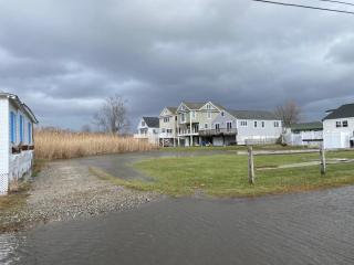
As a coastal town bordering both the Long Island Sound and the tidal Connecticut River, Old Saybrook is front and center in facing sea level rise (SLR) and other natural hazards due to climate change. This issue is a concern to many residents who deal with flooding from tides and surges as well as other storm damage. The Town has been proactive in studying the potential effects of SLR and climate change, and in using this information to plan and implement resiliency efforts.
In 2014 the Board of Selectmen appointed a Sea Level Rise Climate Adaptation Committee to study the likely impacts of climate change and SLR on Old Saybrook’s coast. The work of this committee resulted in a Report of Findings in 2015. This report examined how climate change and SLR could affect Old Saybrook’s environment, the social and cultural character of the town and the local economy. While the committee made many recommendations, the primary one was that the Town should engage a consulting firm to conduct a thorough investigation of the Town’s vulnerability to SLR, especially to infrastructure identified in the Town’s Natural Hazard Mitigation Plan, and to make plans to adapt to, mitigate against or retreat from SLR.
Around the same time, the Town worked with the US Geological Survey to install a gauge at Saybrook Point at the request of the federal government. This tide gauge monitors and records water levels and weather data which is sent via satellite link to the internet. Data from this gauge helps scientists measure changes in sea level in the Old Saybrook area.
In 2016 Old Saybrook was awarded a planning grant from the Connecticut Department of Housing and Urban Development to conduct the study recommended by the SLR committee. The Town hired a consultant to study realistic predictions of SLR and coastal flooding, assess the Town’s vulnerability now and into the future, and engage with the public for feedback throughout the process. The resulting 2018 Old Saybrook Coastal Resilience and Adaptation Study identifies the Town’s coastal flood hazards, assesses the Town’s vulnerability to those hazards, recommends coastal resilience and adaptation strategies, and identifies the steps needed to implement those strategies.
In 2023 the Towns of Old Saybrook, Westbrook, Clinton and the Borough of Fenwick were awarded a Long Island Sound Futures Fund grant from the National Wildlife Foundation to develop a regional coastal resilience plan. The goal of this effort is to identify projects that would have a broader benefit to the long-term sustainability of these shoreline communities and improve eligibility for implementation grants. For more information about this effort visit 4ShoreResiliency.com.
As another SLR adaptation strategy, the Town participates in the National Flood Insurance Program (NFIP) which allows residents to purchase a separate flood insurance policy. Flood insurance is most commonly purchased because it is a requirement made by a lender in order for a property owner to obtain a mortgage or equity loan. For a municipality to be eligible for federal disaster relief aid, FEMA requires participation in the NFIP program. The NFIP program requirements include standards for making structures more resilient to flooding. More information about this program can be found on the Land Use Department’s webpage link to FEMA Flood Information.